Monday, July 31, 2023

Not Even Not Traveling 40.2: Bryce Canyon - Star Talk


Bryce Canyon

Star Talk 

In the morning, I opened my suitcase to rifle through my stacks of t-shirts. The clothes we had brought for summer vacation didn't include winter sweaters or wool socks. We hadn't prepared for low temperatures at night in the mountains. In fact, we had only brought our jackets because we don't trust restaurants and their air conditioning settings. This proved to be correct thinking, as usual. But it also proved to be insufficient for desert stargazing.

I grabbed a fresh shirt. I didn't bother with the jacket because I knew it would be useless in an hour. I stepped into the same shorts I'd been wearing for a couple days.

"We have to get there early," I said with my hand on the doorknob of our bedroom.

"I know!" Diane grabbed her shoes. "I'm the one who set the alarm."

We arrived at the Bryce Canyon vistor center later than I'd hoped. When I counted the people in line for the Star Talk tour, I could see we wouldn't make it into the first group of tourists. We might not qualify for the second group, either. The visitor center had scheduled three tours. I thought we'd make it into the final one. 

While we waited, we talked with our neighbors in line. We met a university professor from Colorado. She had three kids she'd persuaded to come along. We met a woman from Utah, who was on a camping trip with a friend. We met a man from New Jersey who seem sternly worried about his place in line, which was immediately behind us. 

The New Jersey fellow counted up the invisible registrants - the missing children who were getting signed up, the friends still asleep at campsites - which I had done, too, and came to the same conclusion. We were probably not even in the second group. This was a popular tour.

"It's just four telescopes, fifteen people per group."

The name, Star Talk, made me hope we'd get lessons on cosmology. As we discussed the tour with our linemates, though, it sounded as if the Bryce Canyon staff would take us from telescope to telescope with no time for anything more than cursory questions. The park astronomers would aim the telescopes and pre-focus them. We would get a nice view but not much more.

"Have you gone hiking around the canyon?" the woman from Utah asked us.

"A little," I replied. "Today, we've got more planned."

"I'm looking for trails with some trees and shade," said Diane. "This trip has had too many hikes with no protection from the sun."

“Oh you can’t hike in the woods around here." The woman leaned back to laugh. "Everything is rocks!”

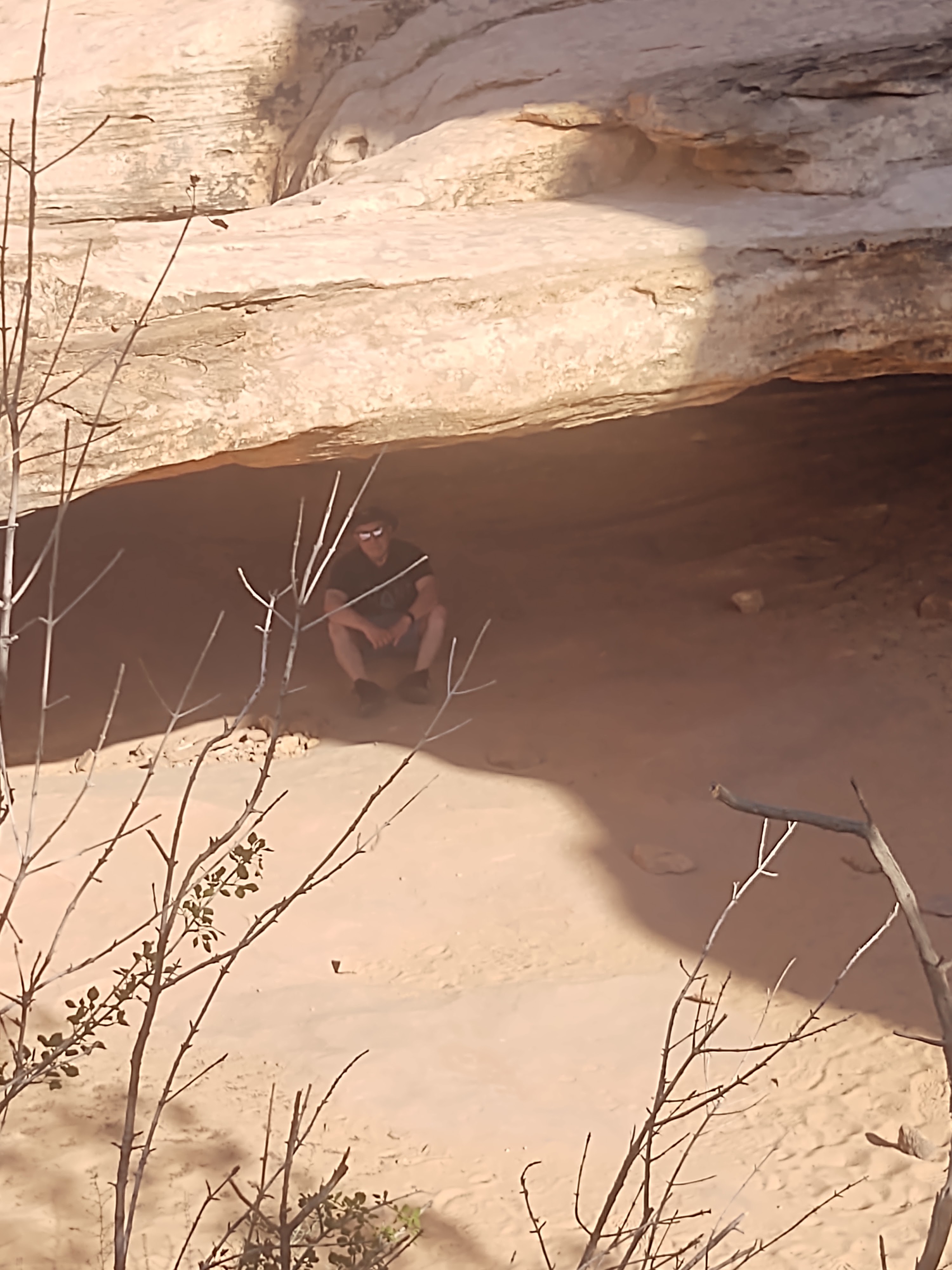
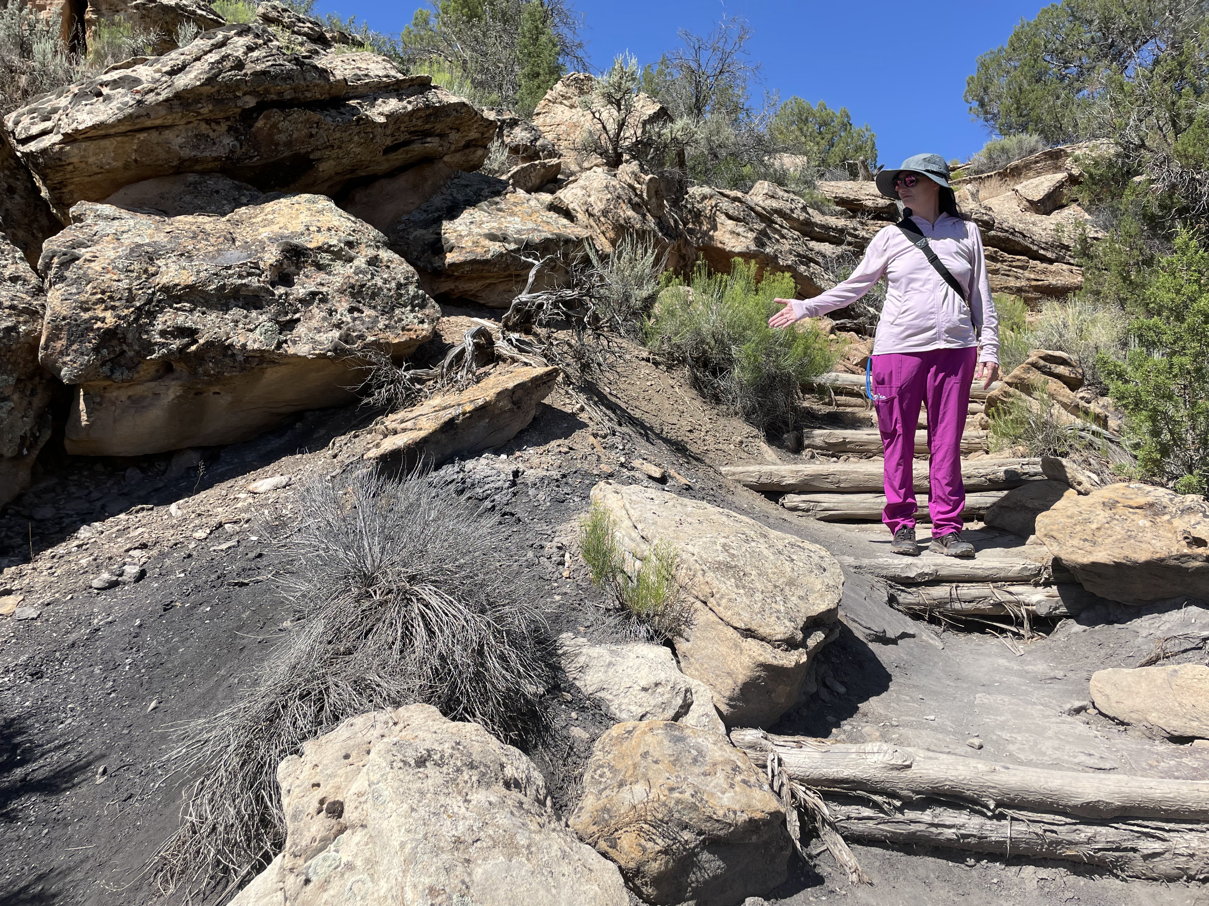
Diane and I knew that wasn't quite true, though. We had hiked the Yovimpe and its bristlecone pines. We knew half of the park is the Dixie National Forest. After we completed our Star Talk sign-up, which put us in the third group, as expected, we drove to a trail head. In less than twenty minutes, Diane found a path that lead down from the rocks into the forest.

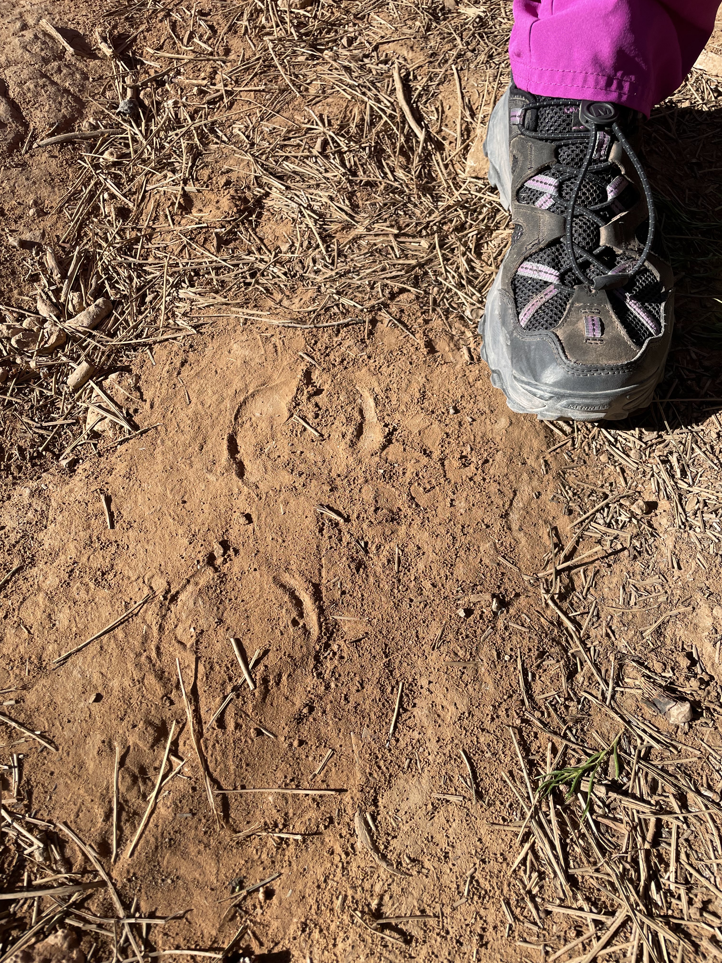
We found pronghorn deer tracks, predator scat from a bobcat or some larger cat, a handful of the tiny squirrels I’d been mistaking for chipmunks, patches of flowers, goose poop, and a tiny stream where the pronghorn apparently came to drink. Probably all the animals did. 

In the evening, we drove to the parking lot where the staff held Star Talk. Unfortunately, the tour really was just looking through telescopes. The staff had chosen Venus, which looked dull and blurry because it was low on the horizon and we had to peer through atmospheric interference. The next telescope pointed at the Hercules Cluster. The sight made me smile. The formation seemed utterly fantastic. I've had the opportunity to look into good telescopes several times but this cluster of T2 stars, more than 22,000 light years away, looked as beautiful as anything.

The next view was a computer-assisted take on the same Hercules Cluster. Horrible and disappointing, like an accurate but uninspired drawing. Finally, we strode to the last telescope, a view of the moon I've seen too many times before.

I was glad I'd lingered over the Hercules Cluster. 


Hercules Cluster via Wikimedia Commons


Sunday, July 30, 2023

Not Even Not Traveling 40.1: Bryce Canyon - Inspiration


Bryce Canyon

Inspiration

At, Bryce we walked into a great visitor center. Not all of the centers in all the national parks have enough staff. Some have lesser information displays or outdated intelligence. The one at Bryce had staff, a geological display, a history of the local tribes, and an additional story on the current re-settlement of the area. The themes of the displays flowed into one another on a rough timeline. Their material all seemed up to date, including the references to the Latter Day Saints and the hints about local water politics.

The only uncomfortable part was making our way through the throngs of people. Lots of folks are interested in hiking around Bryce Canyon. The park staff at the information desk moved the lines in a snappy fashion, though, and we got to the front in reasonable time. There, a park ranger gave us advice on trails.

"But I'm interested in stargazing," Diane said.

"I do that, too," the ranger replied. So we earned another round of advice.

Following his guidance, we drove to where we could try a steep climb to get away from nearby town lights. This was still in the middle of the afternoon. We regarded it as practice for the midnight walk.

Under the harsh gaze of the sun, while covered in SPF 70, long sleeves, and wearing hats, we stopped to look around from the vantages offered by several trail locations. There are strategic views available during the ascent up to Inspiration Point. One of them is a fenced platform at the edge of a mountain cliff. We decided this would be a great place to look at stars because it was so nice and probably safe when stumbling around in the dark, too. 

We continued our hike to the peak. To our surprise, the top of Inspiration Point seemed even better for a midnight walk. We could see farther. We overlooked a range of hoodoos and mesas. The tree cover was beneath us.

"Let's try the trail at the end of the park," Diane said. Her sight of the Milky Way in the sky a few nights earlier provided her with motivation.

"That's twenty minutes more," I complained. Of course, we made the drive to the north end of the park and got out near the Yovimpe trail head. The Yovimpe provided a walk in the shade, something rare in the national parks of Utah, so it was worth the drive for that alone. 

Amidst the path of greenery, I puzzled over the insects and flowers. A hundred yards in, I scooped up a fallen bud with spikes all over it. The base shimmered in a deep, purple color. It turned out to be the seed from a young, bristlecone pine. I'd had no idea their pinecones started out looking different from others. I'd never thought much about the name before. 

Later that night, Diane woke us before midnight to see the stars. But our timing turned out to be a mistake.

"You won't see much with the full moon," the ranger had warned us. We were new to the idea and I, at least, didn't really believe it. After all, we could simply look into some other part of the sky. But the moonlight is sunlight, after all. As we marched to Inspiration Point, we cast deep shadows behind us. We needed no flashlights. As we could see in the sky above, most of the stars had faded out of existence, overwhelmed by the moon. Yet somehow we hoped it would be different from a better, higher place. 

The sky is the sky everywhere. Inspiration Point provided no relief from the moon. When the orb is full and bright, it drowns out everything, everywhere but Venus, Sirius, Antares, and maybe a dozen other, less impressive dots. 

We couldn’t stay up all night. The top of the mountain was 48 Fahrenheit and dropping fast. Winds cut through us and drove away the only other hikers on the mountain. Well, the cold drove them all to their cars except one. As we stood there, wrapped in a blanket, we studied the lights of a hiker below. He or she ventured down a cliff face. The descent seemed to  be going off the trail. A half-minute later, in an awkward, deadly-looking fissure, the light disappeared. 

"Fallen to his death?" I ventured.

"Maybe it was a couple. They got where they wanted to be and turned off the light," Diane suggested.

"That's a happier thought."

"Too cold, though." She shook her head.

Sunday, July 23, 2023

Not Even Not Traveling 41: Mossy Cave


Mossy Cave - Saturday, July 1
 
We took our morning hike to Mossy Cave. This is a seep spring formation that’s spectacular in the winter but doesn't look like much in the summer. We still enjoyed it. It was a great, easy hike. And it’s fun when you know what you’re looking at.

A seep spring forms because most of the rocks in the area are porous sandstone. Rains come in. They soak the ground. They slip through the sandstone layers and keep going. Sometimes the surface of the earth is sandstone for a half mile down. Sometimes it’s only sandstone for a few yards.

When the water hits a layer of non-porous rock, it starts to pool. It forms a source of ground water. Often, the water leaks out the sides of cliff faces. At that point, the configuration is a seep spring.

Apparently above the roof of the mossy cave, there is an unseen, non-porous shelf. Above it, a pool of water more or less continuously overflows into another layer of sandstone. It drips like any other natural spring. It drips all year round, so it supports an ecosystem of local moss and moisture-loving local oddities in this mostly-desert environment. It creates a system of ice columns in the winter.


Near the Mossy Cave site, though, is a stream. It's unusual enough that it's a major attraction to the people on the area trails, especially the kids. For some of the kids, I would imagine it's the only time they've seen a waterfall, even if it's only ten feet high. It is torrent of falling water in a desert land. They are delighted.


Saturday, July 22, 2023

Not Even Not Traveling 39: Capitol Reef


Capitol Reef

After we arrived in the late afternoon to the national park, we stopped by its visitor center. Unfortunately, the building was closed and we couldn't get advice on trails. Outside the doors, we thumbed through the park guidebooks left out on display. Someone from the staff had printed them in a bunch of different languages. They were the most popular languages in the world. Except for one. A label on the display shelf read, 'Klingon.' 


We knew a guide in Klingon was probably a gag. I found it an attractive idea, though. I'll bet it would get more action than Dutch, for instance. Sadly, if someone had printed a real Klingon stack of guides, other tourists had snatched them up. The slot for them lay empty. 

There was no explanation we could see around us for the odd name of the park. As it turns out, though, I could look it up. The locals who created the site name Capitol Reef came at the concept from two angles.


Firstly, the white domes of sandstone in the area somewhat resemble the dome of the Capitol building in Washington, DC. You have position yourself for the right perspective and to squint a bit. Or you need a generous imagination. It's an odd thing to notice, regardless, but someone did.

Secondly, when prospectors came to the area, some of them arrived with nautical backgrounds. They didn't get rich but they stayed long enough to refer to an area now known as the Waterpocket Fold, which is an eighty-seven mile ridge in the earth's crust, as a reef. So a) something that gets in your way on the sea may be a reef and b) this ridge was getting in the way, therefore it was a reef. 


Apparently, folks then put the Capitol dome shapes and the ridge/reef term together. Now we're blessed with this park name that seems almost folk-ishly poetic and, ultimately, doesn't make any sense except as a warning marker that would be subtitled 'how people think.' 

That evening we planned our Capitol Reef hike and chose the Hickman Bridge Trail. Utah has a few natural bridges but this one was supposed to be among the best. Diane felt motivated by it. Plus, we could go early and probably avoid the crowds.


We had perfect timing at Hickman Bridge. There was no one ahead of us. Once or twice, we heard voices from behind. I'm slow, so I worried they would catch up while I was kissing rattlesnakes or whatever it was I was going to do (venture into a shallow cave, as it turned out). Fortunately, the people behind us broke their legs or something. They never did catch up while we were outbound to the natural bridge formation, not even when I insisted on scurrying under the shelves of rock that made the cute little cave.


If I had been eleven, I would have refused to come out. I'd have built a campfire and lived the rest of my life in the cave until someone called me to dinner.
  • Hickman Bridge: an impressive natural bridge but you can't climb it without ropes and pitons so why bother?
  • Tiny little kid-size party cave: excellent, bring a snack. 
On the way back, we met the entire world. (We're still passing some of the people and waving, I believe.) As I said, our timing was perfect. We got to recommend the highlights of the trail to many other hikers. I was able to instigate a dad with kids into exploring the campsite cave. Plus we saw forty or so lizards and what might have been eight extremely fast chipmunks, each a scurrying blur.


Friday, July 21, 2023

Not Even Not Traveling 38: Canyonlands


Canyonlands

We aimed to beat the crowds. Diane and I rose before dawn. We got packed and out the door as the sun started to rise.

But we were still too late. 

It took forty minutes to reach Canyonlands National Park. Although there wasn't much of a line at the park entrance, probably two dozen other hikers launched their hikes before we were ready. When we confirmed the trails we wanted to take, Grand View (the Rim Edge Trail), and Mesa Arch, we drove to the first trailhead to discover someone already returning along the rim edge.

He gave us a polite smile. A few minutes later, not much farther on the same path, we encountered a pair of women heading back along a similar route. From the glow of their skin, they looked like they had completed a high-speed hike.

I wasn't up to their rate, for sure. Even when motivated, I get distracted by the wildlife. Among the weird desert plants, I spotted an adolescent rabbit, small and fast but careless of our presence. Turkey vultures swooped overhead. I wasn't sure if they had been hunting the rabbit or not.

As we proceeded along the rim, we got a spectacular view of the canyons below, especially the hoodoos, which are columns of rock formed when a layer of harder rock presses down and makes the lower, softer layer erode unevenly. The hoodoos can get over a hundred feet high so they are a bit weird to see and walk among. They are armies of forgotten, giant stone chess pawns. Canyonlands, Bryce, Zion, and Arches are famous for them.

The Grand View Rim Edge Trail provided a great walk and a bit more. We got to stand on the precipices along the trail. To get to one of them, I hopped a tiny gap with a cliff below. When I eyed another gap, though, it seemed to eye me back. It was a bit large. So I didn't bother. When there's no reason to hop across a chasm actually, it's hard to justify much distance.


The second trail, Mesa Arch, turned out precisely as described. We hiked around an arch formation that could have belonged to the more famous Arches site. Because it isn't near other formations like it, though, we didn't find it crowded.

Along the way from Canyonlands to Moab to Capitol Reef, we saw a smaller park sign. Curious, we got out for a look. There under a grove of trees, we found petroglyphs. For more, we walked on a raised platform that traversed a line around the the bottom of a cliff. As far as anyone knows, the petroglyphs were left by Fremont Indian ages ago. Even now, they are slowly being destroyed by rockslides and sometimes local vandals. For the moment, there's still something to see.


Tuesday, July 18, 2023

Not Even Not Traveling 37: Arches


Arches National Park, Utah

Crowds. We had been avoiding them. 

However, in two parks on this trip, we couldn't get away. (Well, we discovered a way. More later.) We hit Arches in the middle of the day and ran into throngs. 

The red rocks and yellow shelves of sandstone rose and fell everywhere in the landscape. We felt adrift in the seas of geologic beauty. And yet other human beings plainly clambered all over the place. These other souls were also adrift, sort of. Some bore tired, puzzled expressions. Some beamed with joy. It was much as if everyone had hopped from the decks of the Titanic before it sank and discovered the seas were tranquil and warm. Kids kept complaining about the effort they spent to maintain their continued existence, of course. Someone wondered aloud if this were part of the trip because they had signed up for snorkeling. 

"I forgot my snorkel back on the ship."

"Well, you can't get it now!"

Except it was sunscreen they forgot and it was in the car. And mothers always looked daggers about it.

In short, it was very people-y. But it was beautiful, too. And the wandering, clambering folks around us were wonderful in their very human ways. When I climbed on the precipice next to a cliff so I could lie down in the shade, a woman copied me farther upslope. A different woman held her kids back so they wouldn't walk right next to the plummeting edge. Later, when Diane and I hiked to one of the famous arches, a half-dozen people scooted out of the way near the end of the trail, wordlessly, so we could get a better picture. 

Some hikers asked us for directions. Others posed for selfies. Still more read the signs or pointed out how the natural arches had been formed. They understood geology. Maybe they understood human nature. Once, as we strode along the trail from arch to arch, a couple asked us to take their picture. They politely offered to take ours in return. 

For a thousand specimens of humanity who wanted to get away from their kin in what was supposed to be an isolated, desert wilderness, they were pretty good. They were so polite, in fact, I'd say they were nearly examples of humankind at its best.

Not all of them. But still, they were decent to one another even in the most oppressive, crankiness-inducing heat of the day. 


Monday, July 17, 2023

Not Even Not Traveling 36: Moab and Hell's Revenge


Moab

This is the site of a significant part of the Neal Stephenson book, Fall, so of course I sent pictures of Moab to a few other folks who have read the story. I thought the Uranium Building was the best part. 

In the evening, we strolled up and down Main Street in Moab. Yeah, we visited a few side streets but most of the downtown is on four blocks of a single street, really. It's all nice. 

When we took a seat in a restaurant called Gloria's, we discovered a nearby table of folks who had noticed my t-shirt. It was the second time for it that day. The haiku on my shirt inspired the people around the table to start making haikus. And as we sat down, they approached us. Really, they were sitting so close they talked with us for an hour. During the hour, all the other tables around got involved, too. So it's a pretty friendly town. 


Hell's Revenge Dune Buggies - Tuesday, June 27

After a morning coffee stop, we made our way to the Moab Tourism Center so I could drive a dune buggy. Honestly, I love doing new things and this looked to be one of the good ones. But Diane had the idea, not me. 

They call them dune buggies but the vehicles are ATVs, really. Ours were the Teryx4 model made by Kawasaki. We took them out to drive up mountains and on top of canyon ridges. It's the Hell's Revenge tour.

Does that sound a little advanced? It was a little advanced for someone who hasn't done 4x4 off-roading before.

If you haven't done something like it, here's what it feels like for an experienced driver. For the first 20 to 30 minutes, you are constantly in the I'm in an accident right now mode. Bad things are happening and you're steering and accelerating in order not to die. Everything you're doing would, in fact, be part of an accident in a normal car or under more normal conditions. There's no reason you would climb a mountain in a regular car or tilt at an angle that knocks you out of your seat. A regular car would tip over at the first weird angle, so your instincts are right. You would fall to your death if you tried this in a regular car.


You're not in danger of tipping. But you're constantly aware of the danger.

Add to that the fact that you're driving on a trail precisely wide enough for your vehicle and it slopes off to cliff edges on both sides. You have the impression that a wrong twist of the wheel will kill you. That part is right. Frankly, though, it's often right in many driving situations we think of as harrowing but ordinary. This cliff-climbing and cliff-diving circumstance isn't ordinary so your adrenaline is thrilling through you for longer than it usually does.

The guide placed me at the head of the line of 4x4s. We're not sure why. However, Diane marked on her forms that she might not be comfortable with the experience. And that was correct. And the guide, Jeff, checked on us a few times to make sure she was okay. (She says she was absolutely not okay.)

Jeff told me to copy his moves and I did. He also kept complimenting my driving right up to the end and past the end, when he didn't have to be reassuring. I had sometimes felt the compliments were a little suspicious or maybe he was glad I wasn't being an idiot. (He didn't ask me if I'd done this before until halfway through. So perhaps he was genuinely happy that, as a novice, I had gotten comfortable with the course.) He said nice things even after I parked, tipped, and checked out. We really were done. I started to buy an ice cream bar and he told the cashier to give it to me for free.

Thing is, Jeff was fairly stern with the drivers for a lot of the time. In his job, he has to be. He was also a knowledgeable guide of the area, which Diane and I both appreciate. So I had a lot of fun. Diane, not so much.

Based on our experience, if you drive, you might like it. If you ride along, you're at risk for hating it. Really a lot. You have to not be prone to motion sickness or have any fear of cliff edges or heights. And you have to really, really at a deep level trust the driver. It's a big ask.


Importantly, the experience is a couple hours of adrenaline. You're constantly up against your instincts to avoid an accident. If you consider making the trip, you have to think about whether or not you'd genuinely find the hours of adrenaline to be enjoyable.

And I did. But the course might not be for everyone.


Sunday, July 16, 2023

Not Even Not Traveling 35: Mesa Verde Tour


The Mesa Verde Tour - Monday June 26

The guide service listed us as part of their bus tour.

We didn't stay inside the bus. That was my worry, at first, when I saw the description. But we weren't supposed to stay put and gaze out the windows. The vehicle was simply the means by which the tour company conveyed us from one archaeological site to another. They did so with a fun and knowledgeable guide in charge. She accompanied us in the hiking sections of every site except for the Cliff Palace.

The Cliff Palace is run by the national park service. Their guides are the only ones permitted to lead groups there.

We got off the bus at the first site to see it was an excavation of a kiva. It was pretty huge. Although kivas generally were meeting places, not dwellings, there are signs that people lived at least for months in some of them. You can tell it would be no problem, physically. Kivas can be big. 

One of the most interesting parts of kivas are no longer visible, though. Kiva roofs were woven with small logs. (Small trees were all that were available in the area. There are no sources for large timbers. Materials dictated the style.) The interleave of the logs made them look like upside-down baskets. In fact, the kivas got finished like water-jug baskets, too. In order to make the roofs shed rain, the builders coated the timbers with pinetar and clay to make a smooth surface. Likely enough, they painted some of their kivas, too. All of the buildings in the Cliff Palace, for instance, were plastered and painted. Some of the paint has survived in the dry environment. 

Another fascinating feature is the ventilation systems. Each kiva had to let the outside surface air circulate underground. Since so much of the kiva was underground and airtight, the vents were essential.

Inside the homes of the Mesa Verde sites, archaeologists have found seashells from California, turquoise from New Mexico, cotton from various other nearby regions, plus flints, obsidian, or pottery pieces that had to arrive through trade. Among the Puebloan people who populated Mesa Verde, it's apparent that the men traditionally were the weavers. Women were potters. Perhaps everyone farmed together. 

Local Plants

Maybe the Puebloans didn't know about scurvy but they seemed to have picked up on something about the need for vitamins. Pine tree needles contain vitamin C. Juniper and Pinon pines grow on the mesas. The Puelboans figured out that tea from pine needles was a good thing. That's what they drank.

In addition, they made pinon sap ointment.

Pinon/pinyon/piñon nuts are pine nuts. They're healthy for everyone, of course, and a great source of fat and protein. However, on the mesas in Colorado, Piñon pines only go to seed once every four to seven years. That's not reliable enough to make them a steady food source. In fact, to keep them around, the locals figured out methods of preserving them, albeit imperfectly. Preservation techniques may be how they developed the ointments, which are useful as medicine but conceivably could have started as a useful food supplement, a paste to be used a bit like butter. 

The locals made heavy use of most of the local plants. The wove yucca fibers. They dried pine tree bark to make fire starter. They used shreds of bark as bedding and other types of bark, like juniper, as insulation. Apparently, some shredded bark absorbs water so well, they used it in place of diapers.

They even made use of the center of the juniper berry. That is the source of the 'ghost bead' used in their necklaces. 

They had no way of making gin, though. Apparently, someone on every tour asks.

Water, Water

It's not everywhere. In fact, it hardly exists on the tops of mesas. The mesa residents had to search for it in surprising places. As geologists would note, there are some rocks that are porous to liquids. Sandstone in particular absorbs water like a sponge - the stuff just seeps through and keeps going, falling meters and meters down through the rock until it finds something to stop it. The mesas are mostly sandstone, so rain hits the surface and disappears into it unless it hits a layer where it has to stop. That's where the granite, shale, and other types of non-permeable minerals come in. They block the descent of recent rainfalls. Above them, then, in the columns of sandstone, underground pools form. They are a dependable part of the water table.

If you can't drill through extensive layers of rock, though, how do you find the water? The was the puzzle the natives figured out. The answer lay in the edges of rock formations. At the edges of the cliffs, the entire water process may be revealed. Layers of sandstone meet plates of shale and then, because they are at the edge of the cliff, the water seeps out at that spot. 

Puebloans found these 'seep' springs. Using them as steady source of water, they were able to live on top of the mesas. They practiced dry farming techniques there. They ate prickly pear and yucca fruit, imported squash and beans, and plucked juniper berries. They mashed yucca roots and used them as soap and as dried powder for anti-inflammatory poultices. From similar plants, they formed rope and wove baskets. They made the baskets water tight with pinetar. 

Mesa Verde Cliff Palace

Our park ranger was not as well versed in local history as our bus tour guide. He pointed us to the Cliff Palace official pamphlet for information. He repeated some of it, including how the mesa inhabitants grew crops. The variety of corn they used grew to about knee height by harvest. The cobs were six to eight inches long, no more, and often less when water was scarce.

Surprisingly, the Cliff Palace wasn't inhabited for long. Puebloans did most of the construction between 1260 and 1280. Even as they finished, they started abandoning it. Still, the structure is impressive and deeper than it looks. It is about ninety feet deep. The rearmost layers of structure can’t be seen.

"I do have something to share that's not in the pamphlet," the guide said as we neared the end of the tour.

We stood in a group next to the southmost kiva. 

"You may have noticed how different some of the buildings are," he continued. "Like each is its own domain. Well, I gave a tour here a couple years ago and afterwards, a man separated from it. He told me he was a Zuni. He said the archaeologist explanation that no one knows why the Cliff Palace was abandoned is bullshit. He says the Zuni have an oral history about this place.

"The Cliff Palace was a sort of university. It started as a school where the Puebloans would come to learn about weaving or pottery or medicine or other things. But then the rulers of Cliff Palace started to form a new religion, too. In their religion, the Cliff Palace dwellers were at the top. Everyone else was lower. Most Zuni were supposed to be their servants. That disgusted the Zuni people. They left. And the Cliff Palace kept telling the Zuni families they were lower caste. And they kept leaving. Finally, the Cliff Palace had no servants. Even the rulers of the Cliff Palace had to leave because no one would stay to work for them, not even to learn from them."

I thought it was interesting and actually pretty heartening how the people left because they wouldn’t agree to be lower people in a hierarchy. There wasn't time in the tour to discuss it, though.

On the walls of the Cliff Palace, I noticed a form of plaster. I asked about it and the guide said, yes, all of the walls had once been plastered and probably painted. The structure would have been plastered every year as a form of maintenance. There's evidence on most buildings that someone refinished the walls each winter until the last season of the Cliff Palace, when the final inhabitants abandoned the area. 

Not Even Not Traveling 34: Four Corners and Mesa at Night


Four Corners - Sunday June 25

We were driving by.

Four Corners is a little tourist trap run by the Navajo. It’s cute and doing quite well. We wandered around, bought a couple of knick-knacks, and had a bad photo taken with us in the four states.

Arrival in Mesa Verde

We arrived in time to check in and then we wandered around the area a bit. In the evening, we encountered high elevation horses. They were eating grass on the slopes and they looked well-groomed and unafraid. As we learned the next morning, they are wild animals. The park service is trying to catch them.

At first, the horses escaped from farmers and from the Ute reservation, which is arid and apparently feels mostly inhospitable to horses. The horses found life better as they climbed up the mesa. They've been on the mesa in at least three herds for at least two generations. Early on, the park service kept taking them back to the Ute reservation. But the horses kept escaping the Utes and returning to the mesa.

For their next effort, the park staff captured the wild horses herd by herd and auctioned them off. But the horses are wild, after all, and gave the new owners trouble. Some owners refused to take them when they discovered how wild they were.

Finally, for the last effort so far, which appears to be working, the park service captures the horses herd by herd, ships them off to Texas to be broken in and trained, and then auctions them off. So far, so good. Horse numbers are down by half.

from Wikimedia Commons
Mesa at Night

At 2:30 in the morning, we woke to an alarm. Diane had set the time. She wanted to get up and look at the stars. A few minutes later, dressed and equipped, we stumbled out the front door of our cabin. We saw floodlights around us from the other cabin tenants.

The lights around the compound meant we couldn’t peer into the western quadrant of the sky. We would effectively be star-blinded if we tried. Still, after we manouvered between buildings, roads, and trees, we arranged ourselves to have a clear view of the rest of the heavenly sphere. On top of Mesa Verde, we had no city lights to contend with. We didn't have to endure nearby towns, even. Civilization was a long ways off, as was the light pollution from it.

“Big dipper,” I said as we strolled into the deepest shadow available in the strip of blacktop to the east of our compound. Maybe Diane could see the silhouette of my arm as I pointed to the star formations, maybe not. “And the Milky Way.”

“I don’t remember seeing the Milky Way before,” Diane said. She had followed the gesture.

We studied the sky for a while. I noticed a triplet of stars that were not the Pleiades. I found a reddish possible planet that was not Mars because it wasn’t red enough or in the right position in the sky. (It turns out this was Antares, a star sometimes mistaken for Mars. I learned this by using a sky-mapping app on my phone a few days later.)

“I’ve never seen stars twinkle before,” Diane said. “They really do.”

“Yeah.” I had been noticing it too. “All of them or nearly all.”

We gazed a while longer. She took my arm and told me it was okay to head back.

“It was totally worth it,” she said outside our cabin door.

Saturday, July 15, 2023

Not Even Not Traveling 33: Hovenweep


Hovenweep - Sunday June 25

In the morning, we loaded up and headed to another set of Puebloan ruins. On the drive, almost at the doorstep to Hovenweep, Diane spotted a hopping mouse on the road. After we arrived, I looked it up on my phone. There are indeed hopping mice native to Utah. I still haven't seen one. But Diane has.

Happily for us, Hovenweep provided the best set of Puebloan archaeological examples so far on this trip. Locals built the town in the 1200s, so the building remains might have been labeled as Anasazi at one point. But Anasazi is a Navajo term for “ancient enemy” so as you can imagine it is falling out of favor. Puebloan makes sense; the name indicates ancestors to the modern Hopi, Zuni, Taos, and Acoma peoples.

Even though we'd come for the architecture, which was brilliant, we couldn't help noticing the wildlife. There were, as usual for this climate, about a hundred lizards, a few squirrels, some big-ass rodents that might have been chipmunks on cocaine although they moved so fast it was hard to tell, and we saw warning signs about rabbits, rattlesnakes, and coyotes although none of them were in evidence. Ravens hung around every ruin. They love the park policy of not disturbing the structures. As far as the ravens are concerned, it means no one approaches their homes except maybe a few wrens or chickadees and, to ravens, small birds don't count.

Puebloans built Hovenweep by laying down local stones, which they held together with mud mortar. Because of the mortar, they are comparatively fragile. As soon as people stop living in any place cemented by mud mortar, which needs refreshed every year, the building starts to fall apart. The mortar requires upkeep. Still, the design of these buildings and the entire Hovenweep canyon was obviously excellent. Some of the buildings compare well to the best stone buildings from the middle ages in Europe. Only the use of mud mortar as compared to something more durable has reduced the Puebloan structures. As you wander through, you can see holes in the walls that once held beams and joists for outbuilding structures. There are multiple towers in the town, too. The towers supported several floors ascended by ladders as we’ve seen in similar, more intact buildings.

Hovenweep is the next best thing to Bandolier, which is better a visit than Mesa Verde (IMHO). Although Hovenweep is not by any means a secret, during unpopular visitation times it feels like one. The village feels hidden, forgotten. But wandering through it gives you an awe-inspiring impression of North American history.

Farming

As we saw in Hovenweep and other sites, desert scrub environments meant the locals needed to use dry land farming techniques. The Puebloans of the 1200s apparently did very well with them, too. They imported squash, corn, and a variety of other crops while they made use of the nearby juniper forest, yucca, prickly pear, and cholla. 


Vacancies 

We saw obvious places where a hundred years of fire ashes were dumped daily. In some of those locations, no structures survive, not even flattened ruins. That's why I'd guess that many buildings were entirely constructed of wood or other perishable materials and didn’t survive the eight hundred years - or even the first fifty after the citizens abandoned their town. Alternatively, some of the vacant home sites might have been cannibalized for their logs and stones. As families moved out of an old, small place into two or three new ones, they would have been motivated to use the existing materials. That would explain the ash sites, too.